UAVs (Unmanned Aerial Vehicles – commonly known as a drone) offer many benefits compared to more traditional surveying methods. Cheal has been an early adopter of this technology. Since purchasing our first unmanned aircraft in 2017, we have developed efficient workflows, procedures, and a robust QA system to ensure that our outputs and digital solutions are at the highest standard without compromising safety.
We have a fleet of aircraft with different capabilities, including an RTK LiDAR system with triple return, that allow us to penetrate vegetation and obtain ground levels.
Cheal is a CAA Part 102 certified company. A Part 102 Unmanned Aircraft Operator certificate signifies a level of quality, excellence, and adherence to rigorous CAA standards.
Our UAV operations are done in accordance with our Cheal Unmanned Aircraft Operator Manual and CAA rules which has procedures in place to perform safe operations without creating hazards.
Our Part 102 certificate allow us to:
- Operate within 4km of uncontrolled and controlled airfields.
- Fly over people at construction sites without prior consent & fly over property without prior consent.
- Fly in Low Flying Zones.
- Fly unshielded at night.
- Fly with extended visual line of sight.
UAV Services
- Topographic Surveys
To capture ground levels, topographic features including building, services, signage, road furniture, road corridors, etc of extensive sites. - Environmental Surveys, Vegetation Mapping
Vegetation encroachment for trimming and maintenance. - Earthwork Modeling
Scan to BIM. Scanning for structural analysis, for as built, for future designs and remediation works. - Stockpiles / Quarries Modeling
Creation of digital terrain models for volumes, planning of future expansions, and to support decision making. - Erosion and Slopes Monitoring Surveys
Monitoring of coastal erosion, mapping and monitoring of landslides, slips or steep slopes. - Construction Monitoring Surveys
Sites and assets inspections before, during and after construction. - Infrastructure Inspection
To capture details of non accessible places such as roof or high structures.
Benefits of using UAVs
- Safety
Survey of hazardous or inaccessible areas remotely. - Faster
Capture up to 480,000 points per second. - Richer Datasets
1 to 3cm grids vs 5 to 10m with traditional methods. - Accurate
All our data goes through a robust QA system. - Unobtrusive
All our data goes through a robust QA system. - Deliverables
Variety of outputs, format files and digital solutions.
Cheal provides this service nationwide or internationally if requested.
Contact:
Gisela Ripoll
M: 021 195 2642 | E: giselar@cheal.co.nz
Unlock precision & efficiency: Elevate your surveys with drone technology.


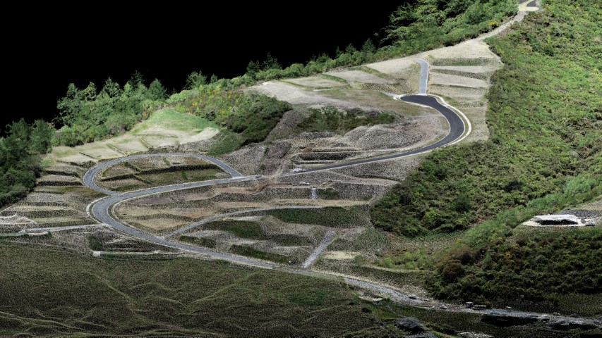
3D visualization of a point cloud captured from our team
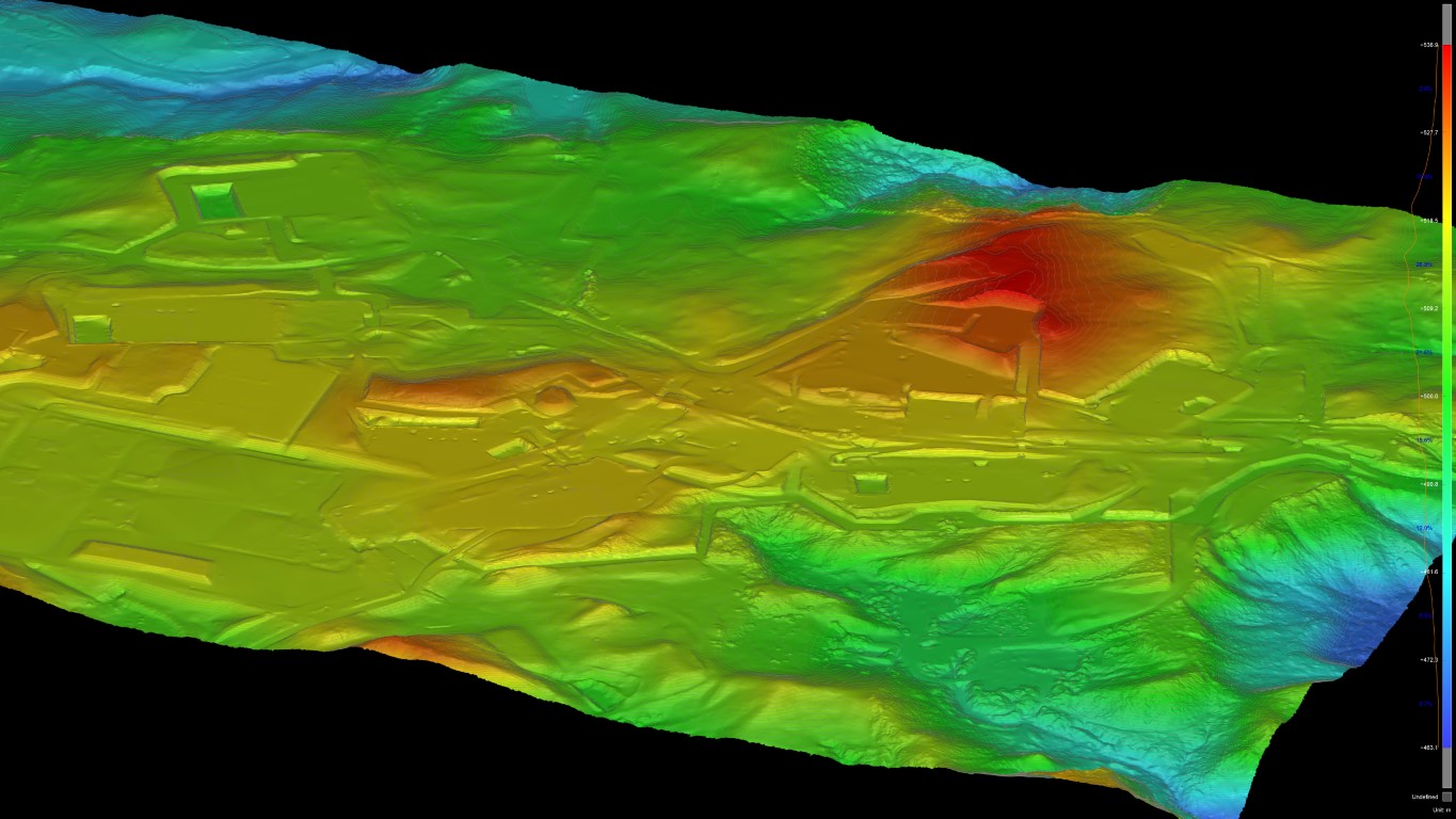
Digital terrain model created from a point cloud (DTM)

Aerial photo of our team doing erosion monitoring survey with UAV
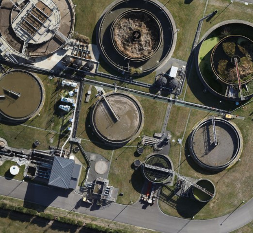
Orthomosaic of a waster water treatment plant
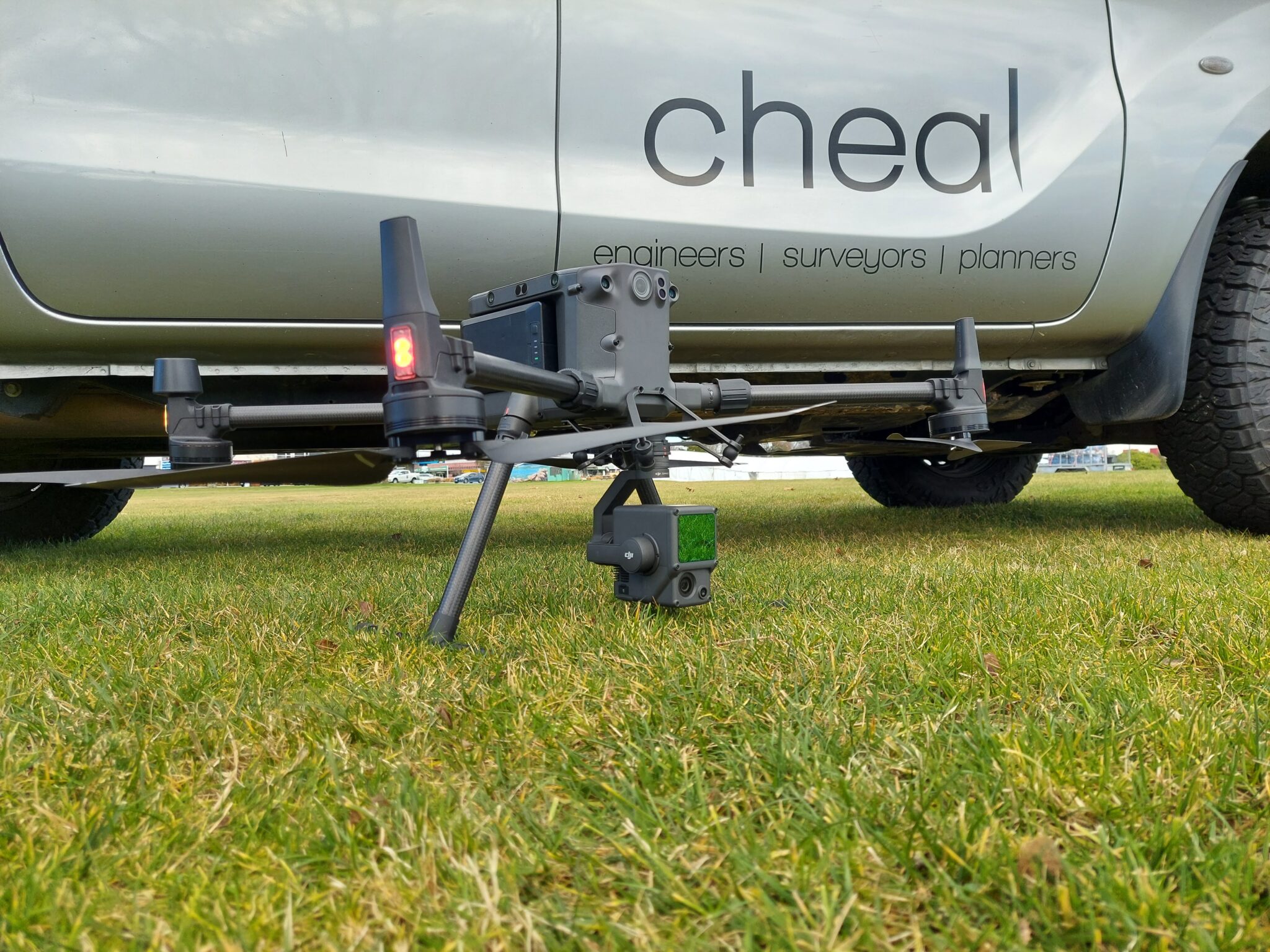
Cheal M300 RTK Drone


