The Mountain to the Sea Cycleway, or Ruapehu to Whanganui Nga Tuhono Trail, is part of a New Zealand government co-funded initiative to build and operate a network of Great Rides cycle routes through the country.
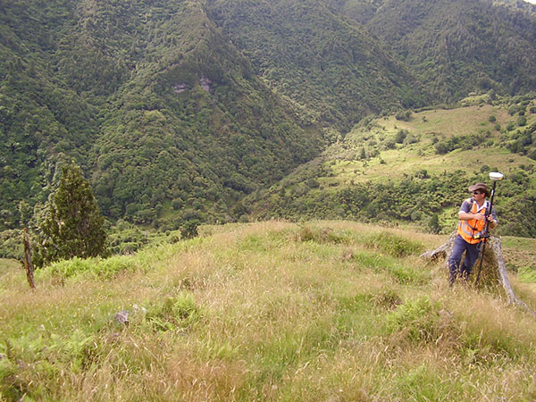
Cheal was engaged by the Ruapehu District Council to survey part of the cycleway alignment running through Fishers Track (an old unformed paper road, to the west of National Park).
The section of track is very remote and steep and the centre line survey of the road alignment needed to show the formed alignment of the road relative to property boundaries. Cheal Surveyors were able to accurately survey the track and at the same time provide the Council officer on-site with a live, digital representation of its position with respect to the legal property boundaries. This allowed for different alignment options to be considered immediately and provided the Council officer with a better feel for the land to assist with site decisions. It also meant that fewer site visits were required, saving both time and money.